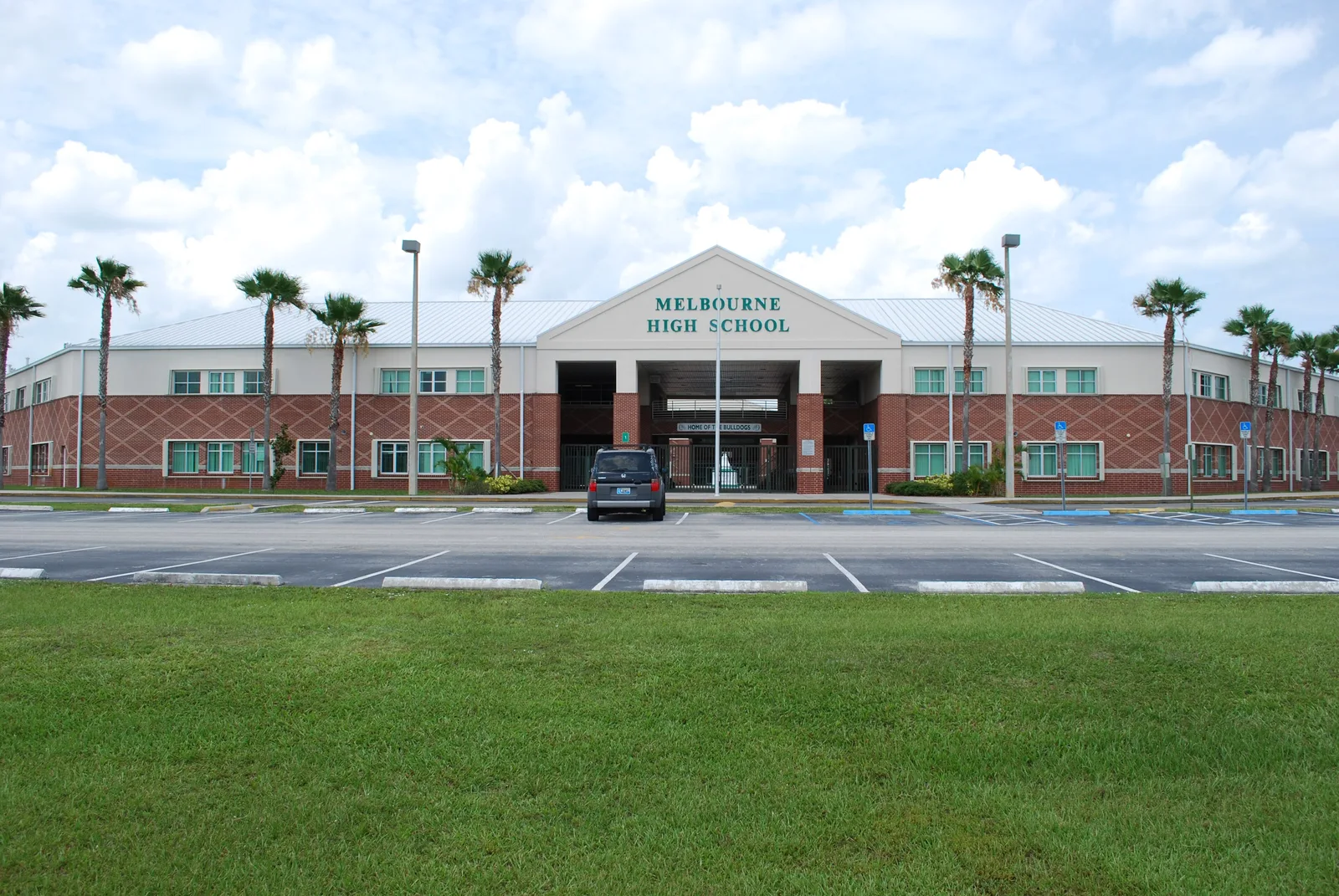
The Babcock Street area was a 540-acre Melbourne redevelopment district until 2024. It is mostly in ZIP 32901 and zoned for Melbourne High, graded A.
Last checked Oct. 10, 2026. Sources: the City of Melbourne’s community redevelopment areas page and the final Babcock Street CRA annual report (archived copies, because the city’s site blocks automated readers), Brevard Public Schools’ 2026-27 attendance zone layers, the Florida Department of Education’s 2026 school grades, Zillow Research and OpenStreetMap.
Babcock Street is Melbourne’s main north-south commercial road between downtown and the airport. For 27 years the blocks along it were the city’s Babcock Street community redevelopment area (CRA), one of three districts where growth in property tax revenue was spent on local improvements. The city ended it in 2024, but its boundary is still the clearest official outline of the area.
What this means for you
- Zoned high school: Melbourne High for the whole area, graded A in 2026.
- Home value: $268,756 in ZIP 32901 in August 2026, according to the Zillow Home Value Index.
- Nearest I-95 exit: Exit 183, Eau Gallie Boulevard, about 6.2 miles by road; Exit 180, U.S. 192, about 6.7 miles.
Part of our Melbourne neighborhoods guide.
Where it is
The CRA was established in 1997 and expanded in 2001 and 2003, and covered about 540 acres, according to the city’s final annual report. On the report’s map it follows Babcock Street north from New Haven Avenue past Hibiscus Boulevard and NASA Boulevard to the blocks around the lettered avenues (Avenue A to Avenue D). South of NASA Boulevard it widens: east to take in Melbourne High on Bulldog Boulevard, Fee Avenue Park and Wells Park, and west along NASA Boulevard toward Apollo Boulevard and the airport. The map shows Holmes Regional Medical Center just east of the boundary. About 91% of its land parcels are in ZIP code 32901 and the rest, at the north end, in 32935.
How it ended. The Babcock Street CRA was terminated on Sept. 9, 2024, under Ordinance 2018-34, the report says. Its last projects were a southbound right-turn lane on Dr. Martin Luther King Jr. Boulevard, bus shelters on NASA Boulevard and a southbound right-turn lane on Airport Boulevard; leftover money in the trust fund went back to each agency that paid into it. Assessed value inside the district had grown from a base of $74.6 million to $259.8 million as of Jan. 1, 2025.
Schools
From Brevard Public Schools’ 2026-27 attendance zone layers, with grades from the state’s 2026 school grades. Shares are of the land parcels in the area on Brevard County’s parcel map:
| Level | Zoned school | Share of the area | 2026 grade | 2025 grade |
|---|---|---|---|---|
| Elementary (K-6) | Harbor City Elementary, 1377 Sarno Road | About 92% | B | C |
| Elementary (K-6) | University Park Elementary, 500 W. University Blvd. | About 8%, the south end | C | C |
| Middle (7-8) | Hoover Middle, 2000 Hawk Haven Drive, Indialantic | About 83% | A | A |
| Middle (7-8) | Stone Magnet Middle, 1101 E. University Blvd. | About 17% | C | C |
| High (9-12) | Melbourne High, 74 Bulldog Blvd. | All | A | A |
Melbourne High stands inside the area; the state’s file gives it a 97% graduation rate for the class of 2024-25. Check any address with the district’s School Zone Locator, and see our schools guide.
Home values
The typical home value in ZIP 32901 was $268,756 in August 2026, down 1.7% from $273,487 a year earlier, according to the Zillow Home Value Index. It is a modeled typical value for the middle third of homes across the whole ZIP code, not a sale price. The figure for Melbourne as a whole was $356,996, down 1.0%. See our home prices guide.
Parks and the library
From OpenStreetMap and our parks and trails guide:
- Fee Avenue Park, inside the area, and the city’s Fee Pool, 114 E. Fee Ave.
- Wells Park, at the area’s eastern edge.
- Nearby: Babcock Park, Magnolia Manor Park and Melbourne Military Memorial Park.
- Melbourne Public Library, 540 E. Fee Ave., just east of the area.
Getting around
- City Hall: about 2 miles by road from the middle of the area.
- I-95: Exit 183, Eau Gallie Boulevard, is about 6.2 miles by road and Exit 180, U.S. 192, about 6.7 miles.
- Airports: Melbourne Orlando International Airport is about 2.4 miles by road and Orlando International Airport about 62 miles. These are distances on the OpenStreetMap road network, not drive times.
- Buses: Space Coast Area Transit’s stop data shows Routes 21, 24, 25, 29 and 30 stopping in or next to the area. Routes 21, 24 and 29 have no fare for Melbourne residents riding inside the city, SCAT says. Check the 2026 system map and our getting around guide.
Groceries and everyday stores
OpenStreetMap lists a Publix at 1411 S. Babcock St. and a Walgreens at 975 S. Babcock St., both inside the area. A CVS Pharmacy at 15 E. New Haven Ave. is just south, in downtown.
Nearby areas
Downtown, Florida Tech and University Boulevard and Eau Gallie.
Frequently asked questions
What was the Babcock Street CRA?
A City of Melbourne community redevelopment area of about 540 acres along Babcock Street, created in 1997 and expanded in 2001 and 2003. It was terminated on Sept. 9, 2024, after its last projects were finished, according to the city’s final annual report.
What ZIP code is the Babcock Street area in?
Mostly 32901, with a northern strip in 32935. Zillow put the typical home value in ZIP 32901 at $268,756 in August 2026, down 1.7% from a year earlier.
What schools is the Babcock Street area zoned for?
Melbourne High, graded A in 2026, for the whole area. Most of it is zoned for Harbor City Elementary, graded B, and Hoover Middle, graded A, but the lines split, so check the address.
Is the Babcock Street area a good place to live?
The Babcock Street area is a former 540-acre city redevelopment district with Melbourne High, a Publix, a Walgreens and Fee Avenue Park inside it, zoned for Melbourne High, graded A in 2026. The typical home value in ZIP 32901 was $268,756 in August 2026, according to Zillow.
Have your say