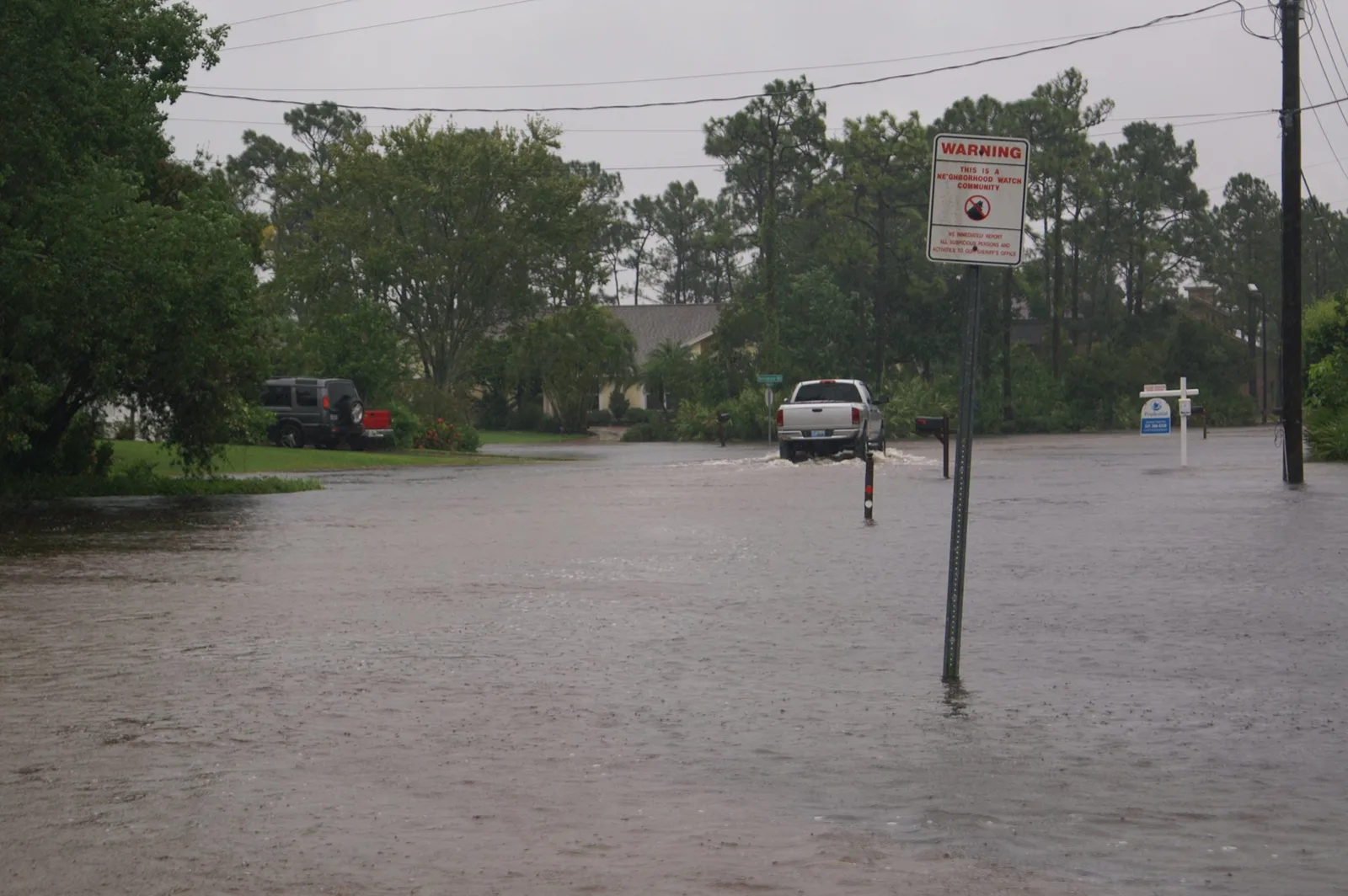
The watch forecast 1 to 3 inches and up to 5 in spots. The weather service office in Melbourne measured 14.95 inches, and south Brevard topped 24 inches.
Updated Nov. 6: the rain was far heavier than this watch forecast. The National Weather Service office in Melbourne measured 14.95 inches from Sunday to Tuesday noon, and spots near Grant-Valkaria and Malabar topped 24 inches. The flooding broke a water main, and the city’s boil water notice ran from Nov. 2 until it was lifted Nov. 5. The outcome, the cleanup help and the rising St. Johns River are in our follow-up story. The original story, as published Sunday, follows.
Melbourne and all of mainland Brevard County are under a flood watch until 3 p.m. Monday. The National Weather Service in Melbourne issued the watch at 12:39 p.m. Sunday.
The office expects widespread rain of 1 to 3 inches, with localized totals of 5 inches or more that “may cause flash flooding.” The ground is already close to saturated, the watch says.
A watch means flooding is possible. It is not a warning. The weather service said people in flood-prone areas “should be prepared to take action” and should watch for possible flood warnings.
What the weather service is forecasting
The flood watch and the office’s Sunday afternoon forecast discussion lay out the next 24 hours:
- Rain: bands of heavy rain through Monday afternoon, as a disturbance from the Gulf meets “unusually rich moisture” over Central Florida
- Totals: 1 to 3 inches widely through Monday night; the discussion says some spots could reach 5 to 8 inches
- Where it floods first: poor drainage and urban areas, creeks, streams and low-lying, flood-prone places
- Storms: occasional lightning and gusts of 40 to 45 mph
- Area: mainland, inland and barrier island zones in both north and south Brevard, plus Indian River, St. Lucie and Martin counties
The Melbourne forecast puts the chance of rain at 80% tonight, with 1 to 2 inches possible overnight. Monday’s chance is also 80%, with a high near 81 degrees.
The discussion also warns that heavy rain at high tide can flood worse, because water drains more slowly into tidal waterways.
The river and the beaches
The Indian River gauge at Melbourne read 1.81 feet above the average daily high-water mark at 5:54 p.m. Sunday. That is just over its 1.8-foot “action” level, the National Water Prediction Service shows. Minor flooding at the gauge begins at 2.5 feet.
At the beaches, conditions are dangerous:
- High surf advisory until 7 p.m. Monday, for breaking waves of 5 to 7 feet and localized beach erosion
- High rip current risk through late Tuesday night, under the rip current statement for coastal Volusia, Brevard and Indian River counties
“Entering the surf is strongly discouraged,” the weather service said. Its advice if caught in a rip current: relax and float, don’t swim against it, and swim along the shoreline if you can.
This comes a week after the coastal flood warning of Oct. 25-27, which we covered here.
What it means for you
- Tonight and Monday morning: expect standing water on low streets and in parking lots, and allow extra time on the drive to work and school.
- Don’t drive through water on the road. The weather service’s flood safety page explains why a few inches of moving water is enough to move a car.
- Watch for an upgrade. A flood warning means flooding is happening or about to.
- Stay out of the ocean at Melbourne Beach, Indialantic, Indian Harbour Beach and Satellite Beach through Tuesday night.
- Lawns: the city’s winter rule allowing irrigation one day a week started Sunday. With this much rain, sprinklers can stay off. Details are in our watering story.
Power out in the storms? Our power outages page lists who to call. Road closures go on road construction and closures. For a longer storm checklist, see hurricane prep.
We will update this story when the watch ends or is upgraded.
Have your say